Published on: 08/02/2026
Last edited on: 23/05/2026
Chinaga betta is a nice little day hike bear Bengaluru. It is said to be 2.1 kms one side, so in total of 4.2 kms up and down. It’s a simple hike, can be done with family and friends. I recently got to visiti it and I am gonna mention how was the experience. First thing is it needs permit, so book it from arayna vihaara website. Choose a convenient slot, in my time it was just 6 AM to 6 AM. This is needed cause it’s said that a forest ranger will accompany you to the top, I say it that way, cause surprise surprise there was no one when we reached there.
Trek starts from the base of temple Torana Anjaneya Swami Temple. This is where forest department is supposed to check your IDs before starting. There were a lot of locals when we reached there, its a temple which seemed super active and when we were returning it also seemed they were in the process of sacrificing a goat. We didn’t stand back to see that. Well that’s for a later bit, first in the start, when we were approaching base of the temple we were very scared as it was pitch black and when we entered forest side, it started to feel like off roading. So driving through a lonely road in night with no one in sight, was a bit concerning, but when we reached there and saw few fellow hikers we were relieved.
We waited for forest ranger till 6, but when we realized we were played for a fool, we just started on our own. So yeah, 250 rupees went in vain :(
Okay, next thing, let’s talk about the actual trail. We followed trail from this website. I would divide whole hike into four sections, first is big temple to small temple, next is rocky/slaby tiring uphill section, next is flatlands and finally the last remaining part to the summit.
Forest ranger is mostly not needed for the hike’s majority, it’s just that at the top, there’s a vertical rock, which you have to climb and most people would not be comfortable doing that. I was a climber so I climbed it pretty easily (subtle flex xD). Hike starts at the back of the temple, and there’s a outward protruding rock at the top, which has a flag above, that is your summit.
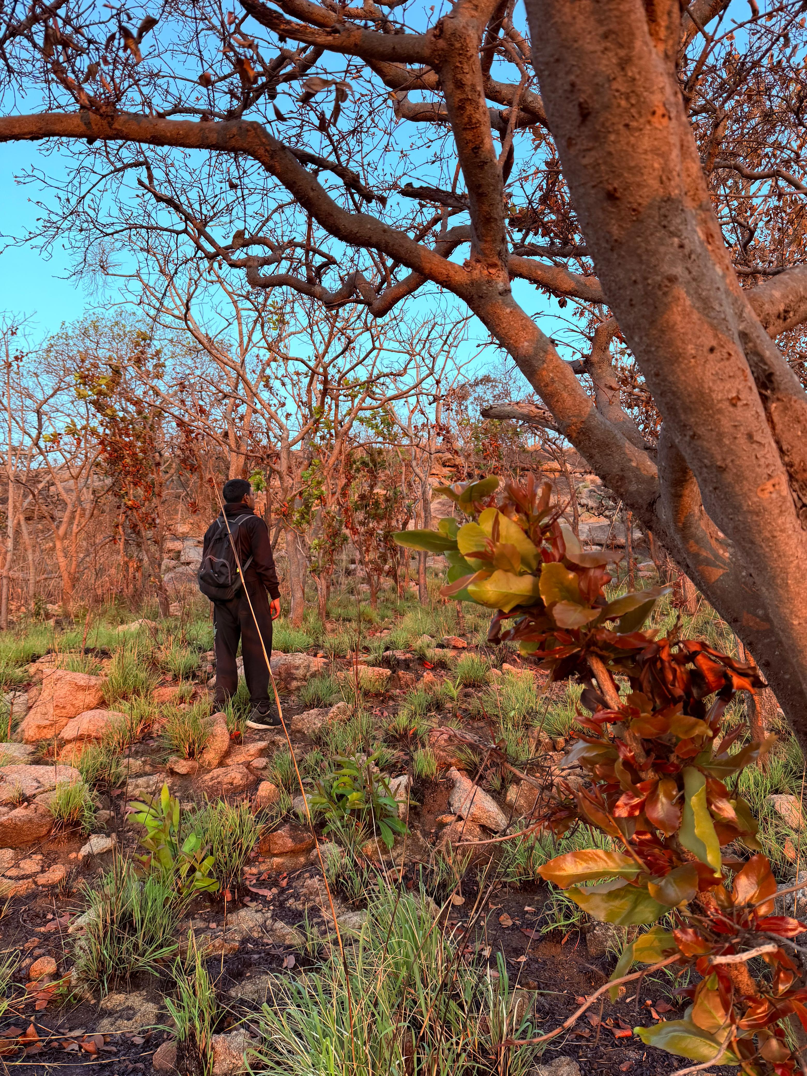
First part when we start from the back of the temple, there’s a trail which seems to go in the forest, follow that. Once you follow that you will reach another small temple. There will be two paths there, and just as Robert Frost’s protagonist, we have to the road less taken. This is first part done, its just light walking, perfect warmup for the next tiring section.
Next section is a where uphill starts, its through mildly dense forest, well it was less denser cause we could see people there had burnt a lot of trees to keep it clear for trail. This section is also where we saw sunrise. It would have been better to watch it from flatlands above, but we were late due to waiting for forest ranger :(
This section is also slippery at times, two of my friends survived the slip, but it could get dangerous, so either wear good shoes or be extra careful where you are stepping and how you are shifting body weight. It shouldn’t be a problem for most people, but extra caution is never harmful.
There’s a section between flatland and this uphill where you will start seeing eucalyptus trees. They are beautiful with little yellow flowers on them. This gave me a feeling of walking through magic forest of berserk. If locals hadn’t burnt a lot of trees, I wonder if I would have declared it Garden of Eden.
Also while going uphill you will notice white arrows, follow them. Though you could also just rely on the trail map you have downloaded, it was on OpenStreetMaps on IndiaHikes website so you could use any FOSS maps app to view it.
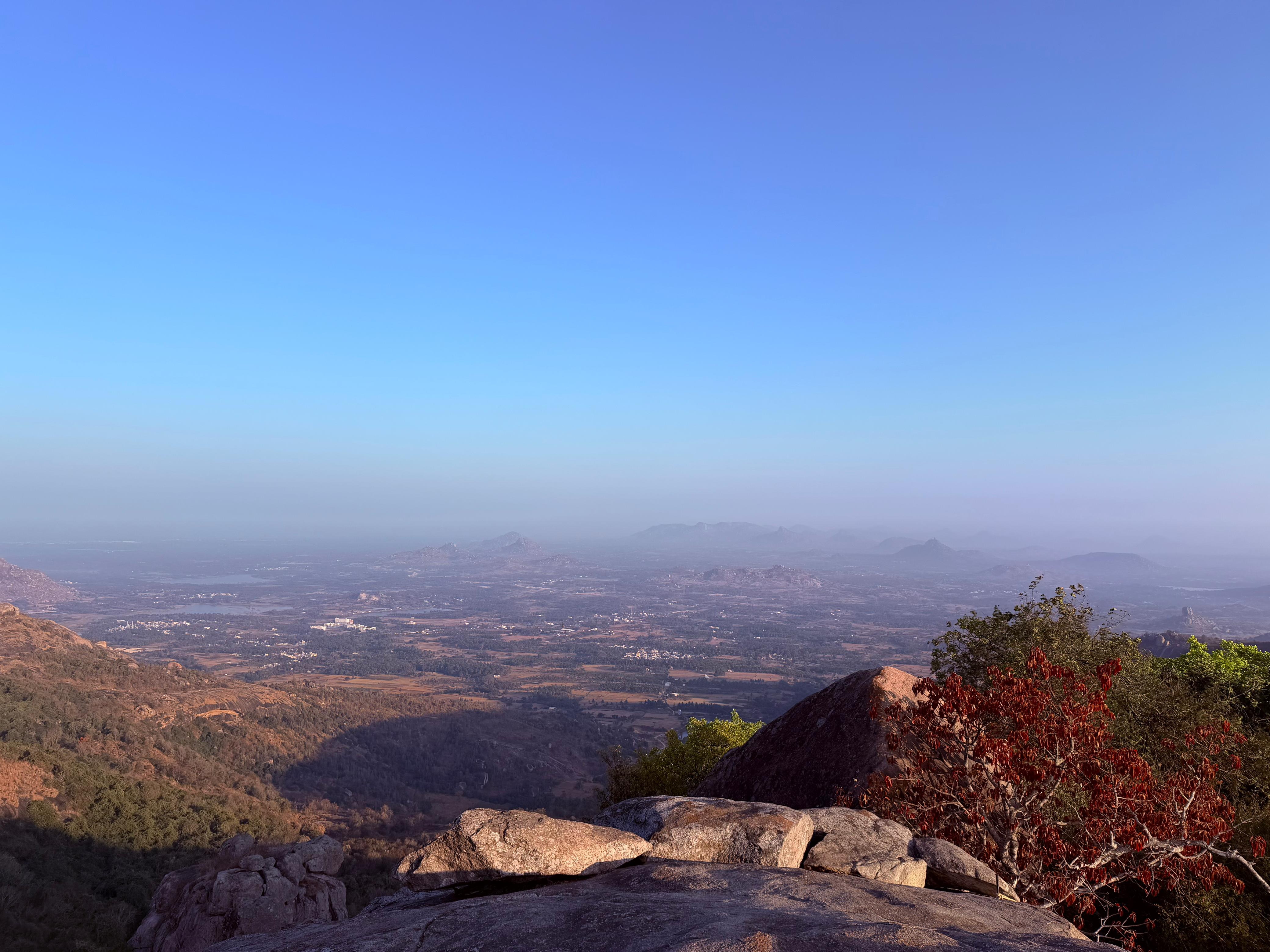
Next section is flatlands, it is what the name says. I don’t think it’s called flatlands in any blog or something, but I am calling it that cause of minecraft biome xD This is one spot you can catch sunrise. Best would be top, but even this is fine. From here you would start getting views of surrounding area. Its serene, breathe in and get ready for the remaining part!
Now, next is walking through some part of flatlands to reach farthermost bottom of last section, there should be a easily visible trail starting there. Just follow that.
As you walk through the last section, you will come across two big rocks creating a narrow space between them. You have to squeeze and pass, that is also very slippery, but all I could think at that point is, if I could climb this chimney 😂
Once you complete that you would reach the final vertical rock which you have to climb. There’s a rope there to assist but it seemed we were the first one to reach so it was thrown above!? Not sure why would someone do that. It looks like this:
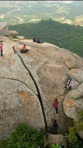
It doesn’t look much but there’s no proper footing down below, so if you slip you can get injured. And getting up is one thing, getting down is more scary unless you have someone looking at your feet and telling you where the footholds are.
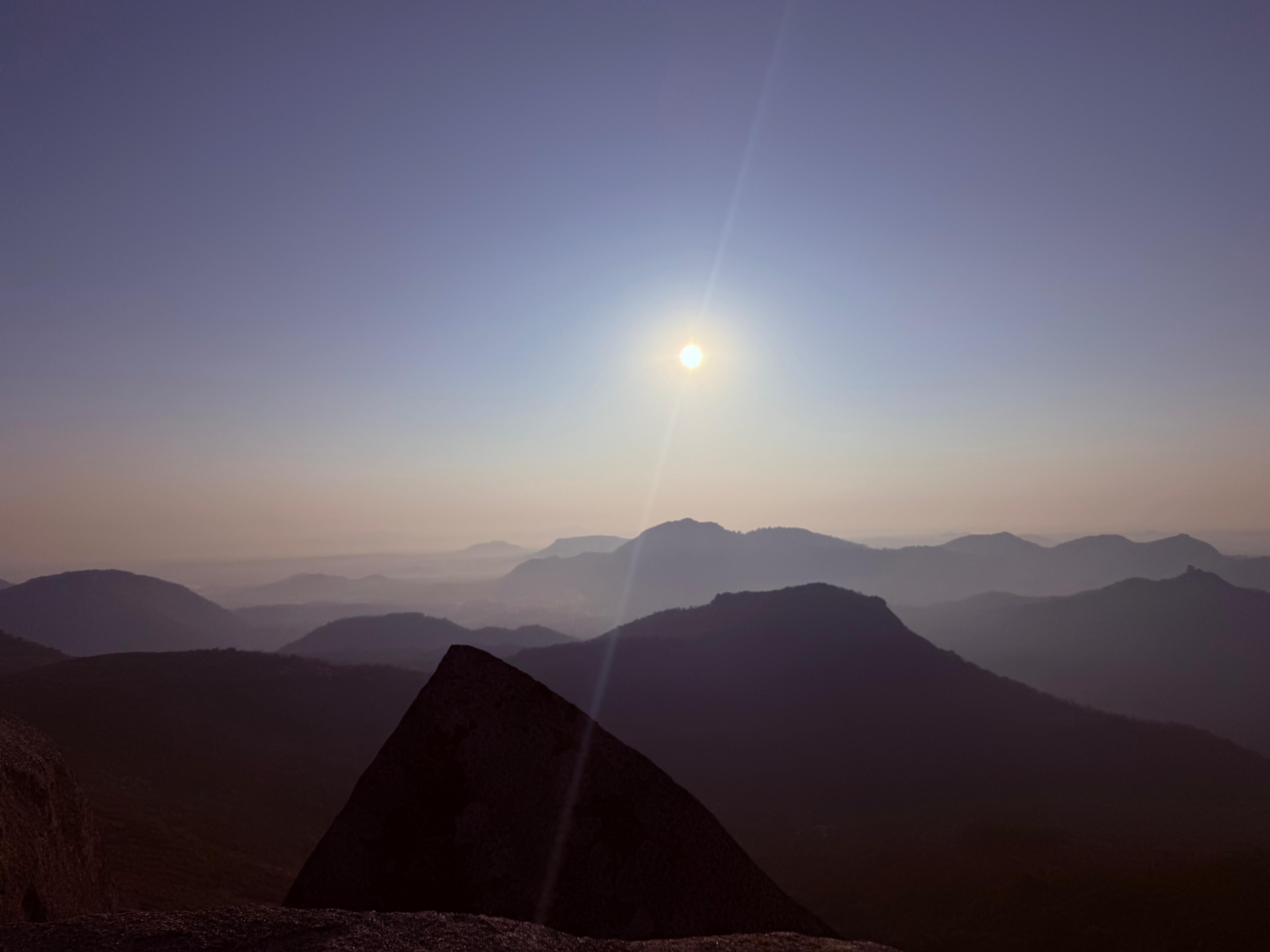
They are also carved inside the rock, and not projecting outwards. Also part of the reason why when getting down you have to look for them. Well, getting back in our case, I was the guy who got pushed forward to climb to get rope from above. I had no safety, so my friends were a bit concerned but I was confident as I had climbed much higher rocks with much dicier footholds and handholds as compared to this in Hampi. I threw the rope down and assisted everyone else to climb above. As we reached above, we could get a much clearer view of everything around, it’s a beautiful place. On one side, you are seeing mountains till eyes can reach, covered with a blanket of clouds. Next side, you see tiny settlements, with lesser hills, perfect for people to make actual small towns around. While it’s not a lot of height, wind there was super strong. So if you are lean and light weight, please don’t fly off xD
We had a dog guide us the whole time, she was so cute and playful, unfortunately she disappeared when we completed the hike, so we couldn’t treat her :( We also could not carry her to to topmost section as that was a climb on a straight rock. It wasn’t the biggest but not possible for us to do with a dog.
And yeah that’s it, we came down the same path, but there’s another surprise waiting for you after hike, we stopped by the Swandenahalli Lake. We think it’s a small pond rather than a lake. We chilled there for some time, skipped some stones which itself was good enough to offset lake vs pond disappointment :)
And that’s it on the way back we tried Pavithra Idli Hotel’s Benne thatte idili, vada and masala dose. They have been cooking since 1942 and are pretty famous, we had to wait for 10-15 minutes to get a seat on a Saturday morning. Benne Thatte idli wasn’t upto to the hype for me, I have had better ones near in Jayanagar. But Masala dose was better and we watered everything off with a hot filter coffee, always the best part for me xD It’s worth a try once :)
And that’s it, enjoy and have a nice trip.
References: https://indiahikes.com/documented-trek/chinaga-betta-trek